Sächsische Schweiz

Landscape Protection Area

Description & Map

Summary

Older than the national park is the Saxon Switzerland landscape conservation area, which surrounds both parts of the national park and completes the national park region. Table mountains, plateaus, rocky gorges and the Elbe valley form a diverse cultural and natural landscape.

Description

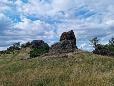
The natural area of the Elbe Sandstone Mountains on the left bank of the Elbe is characterised not only by natural forms of erosion but also by the close interlocking of forest, open land and settlements. Natural, ecological, cultural and aesthetic values merge here to create an unmistakable overall impression for which this landscape is so well known. The designation of the Saxon Switzerland landscape conservation area in 1956 (287.5 km²) is linked to the task of preserving nature and landscape in their entirety and ensuring their special recreational suitability. This is to be achieved through traditional and sustainable land use and maintenance. In addition to environmentally friendly agriculture and forestry, all forms of gentle tourism and a settlement development limited to its own needs, which blends harmoniously into the landscape, are particularly important. Since 1972, the Elbe Sandstone Mountains (Labské pískovce) landscape conservation area (250 km²) in the Czech Republic has been connected to the German landscape conservation area - an important prerequisite for the uniform protection across the border.
General information

Responsible organizations

report

Current information

do_not_disturb_on Forestry work in Berggießhübel forestry district July 6, 2026 - Aug. 14, 2026 From 6 July until 14 August at the latest, forestry work is taking place along the K8751 street between Markersbach and Bahra as well as on the surrounding slopes. The street will be completeley closed for traffic, but the closure will move and always be only in the area where there is active work so that access for residents is always ensured. The diversion route for cars leads via Raum (district of Bielatal). show details
do_not_disturb_on Forestry work in Liebethaler Wäldchen area July 6, 2026 - Aug. 14, 2026 From 6 July until approx. 14 August 2026, forestry work is taking place in the Liebethaler Wäldchen area. No marked hiking trails are affected. show details
do_not_disturb_on Forestry work in Rosenthal district June 29, 2026 - Aug. 14, 2026 show details
do_not_disturb_on Closure between Waltersdorf and Porschdorf April 14, 2026 - Dec. 31, 2026 (preliminary) The Ehrlichtweg/Klahrens Grund between Waltersdorf and Porschdorf is currently closed for safety reasons. The closure was put in place by the city administration of Bad Schandau. Measures to make the trail safe again are already planned. Please refrain from using the trail for your own safety until it is opened again. show details
do_not_disturb_on Closure of René Prokoph trail March 31, 2026 - Dec. 31, 2027 (preliminary) From 7 April 2026, the René Prokoph trail has to be closed due to construction work for the replacement bridge in Bad Schandau until further notice. It can currently not be said how long the closure will have to be in place. show details
do_not_disturb_on Waldnadel Jan. 15, 2026 - Aug. 15, 2026 show details

Wildlife

Fauna

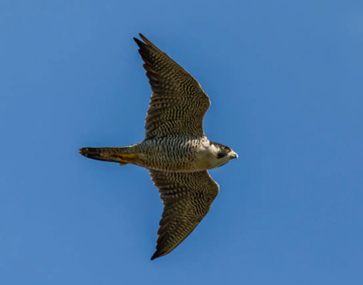
Wanderfalke

landscape

Habitat

Silikatfelsen mit Felsspaltenvegetation

Rules

Mountain activities

dtp_climbing_allowed_regular

dtp_designatedpathsplaces_allowed_regular
Climbing is only allowed on

Designated paths/places when it is Dryness

Artificial aids or chemical/mineral substances (e. g. magnesia) are not allowed.New climbing routes may be developed on the confirmed climbing peaks, but the ascent must take place from the bottom to the top.

Stay activities

dtp_camping_allowed_regular

dtp_designatedpathsplaces_allowed_regular
Camping is only allowed on

Designated paths/places

Air activities

dtp_airsport_forbidden_regular

Air sport (starting and landing) is forbidden

dtp_dronesmodelplanes_forbidden_regular

Drones/model planes is forbidden

Report an error