
Entering off the beaten path is forbidden.
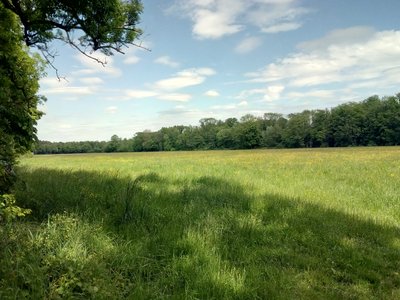
The nature reserve at Bruchbach and Otterbach stretches along the valley areas of these streams and encompasses a highly branched water system with straightened streams, ditches, and standing water. It is home to a variety of habitats, including reeds, wet and marshy meadows, tall forb communities, large sedge marshes, and near-natural forest areas. Particularly noteworthy is the unspoiled landscape on the edge of the Bienwald forest, with the Otterbach stream between Jockgrim and Kandel being a near-natural watercourse of supraregional importance.
| Location | Germany - Rheinland-Pfalz - Germersheim, Südliche Weinstraße |
| Website | https://berichte.naturschutz.rlp.de/oneo/nsg/NSG-7300-103 |
| Area | 15.41km² |
| Year of foundation | 1988 |
| IUCN Category | IV |
| DtP ID | 2f3b9cbe-20cd-495f-8db2-967397815407 |
| Name and division |
Stiftung Natur und Umwelt Rheinland-Pfalz
|
| Website | https://snu.rlp.de/ |
| Address |
Show address Hide address
Diether-von-Isenburg-Straße 7
55116 Mainz Germany |
Entering off the beaten path is forbidden.


Horse riding is only allowed on designated paths.

Camping is only allowed at designated places.

Camping and bivouacking is only allowed at designated places.

Camping with vehicles and trailers is only allowed at designated places.

Drones and model aircraft are forbidden.

Disposing of waste is forbidden.

Fire is forbidden.

Dogs on a leash are allowed.

Photography and filming is forbidden.
It is prohibited to visit, photograph, or film animals at their nesting, breeding, living, or refuge sites.