Tato platforma byla přeložena s pomocí umělé inteligence. Pokud si všimnete chyb, uvítáme příspěvky komunity; napište nám prosím na platform@digitizetheplanet.org.

Sächsische Schweiz

Chráněná krajinná oblast

Popis a mapa

Shrnutí

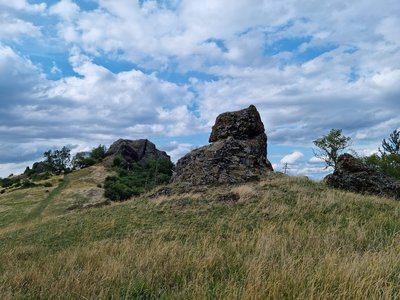
Older than the national park is the Saxon Switzerland landscape conservation area, which surrounds both parts of the national park and completes the national park region. Table mountains, plateaus, rocky gorges and the Elbe valley form a diverse cultural and natural landscape.

Popis

The natural area of the Elbe Sandstone Mountains on the left bank of the Elbe is characterised not only by natural forms of erosion but also by the close interlocking of forest, open land and settlements. Natural, ecological, cultural and aesthetic values merge here to create an unmistakable overall impression for which this landscape is so well known. The designation of the Saxon Switzerland landscape conservation area in 1956 (287.5 km²) is linked to the task of preserving nature and landscape in their entirety and ensuring their special recreational suitability. This is to be achieved through traditional and sustainable land use and maintenance. In addition to environmentally friendly agriculture and forestry, all forms of gentle tourism and a settlement development limited to its own needs, which blends harmoniously into the landscape, are particularly important. Since 1972, the Elbe Sandstone Mountains (Labské pískovce) landscape conservation area (250 km²) in the Czech Republic has been connected to the German landscape conservation area - an important prerequisite for the uniform protection across the border.
Obecné informace

Odpovědné organizace

Aktuální informace

Najeďte kurzorem na oznámení a zvýrazněte jej na mapě.

Closures due to helicopter operation 29. září 2026 - 1. října 2026 (předběžné) zobrazit podrobnosti
Bridge at the Buttermilchmühle closed 24. září 2026 - 31. října 2026 zobrazit podrobnosti
Closures because of forest liming 24. září 2026 - 2. října 2026 (předběžné) zobrazit podrobnosti
Forestry work in Berggießhübel forestry district 18. září 2026 - 31. října 2026 zobrazit podrobnosti
Closures due to forestry work 15. září 2026 - 30. listopadu 2026 zobrazit podrobnosti
Forestry work near Ulbersdorf 18. srpna 2026 - 30. září 2026 zobrazit podrobnosti
Forestry work in Rosenthal forestry district 17. srpna 2026 - 31. října 2026 (předběžné) zobrazit podrobnosti
Closure of the forest area between Bastei, Rathen, Hohnstein and Polenztal up to Frinztalmühle 1. srpna 2026 - 16. října 2026 (předběžné) zobrazit podrobnosti
Closure between Waltersdorf and Porschdorf 14. dubna 2026 - 31. prosince 2026 (předběžné) zobrazit podrobnosti
Closure of René Prokoph trail 31. března 2026 - 31. prosince 2027 (předběžné) zobrazit podrobnosti

Živá příroda

Fauna

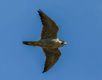
Wanderfalke

Stanoviště

Kalkarme Felsen mit Bewuchs

Pravidla

Horské aktivity

dtp_climbing_allowed_regular

dtp_designatedpathsplaces_allowed_regular

Lezení je povoleno pouze ve vyhrazených oblastech za sucha.

Artificial aids or chemical/mineral substances (e. g. magnesia) are not allowed.New climbing routes may be developed on the confirmed climbing peaks, but the ascent must take place from the bottom to the top.

Pobytové aktivity

dtp_camping_allowed_regular

dtp_designatedpathsplaces_allowed_regular

Táboření je povoleno pouze na vyhrazených místech.

Letecké aktivity

dtp_airsport_forbidden_regular

Vzlétnutí a přistání při leteckých sportech je zakázáno.

Obecné chování

dtp_dronesmodelplanes_forbidden_regular

Používání dronů a modelů letadel je zakázáno.

Nahlásit chybu