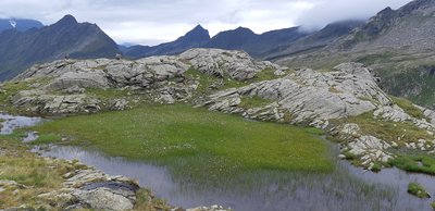


Utiliser des véhicules motorisés est uniquement autorisé sur les voies publiques.
La traduction française de cette plateforme a été créée avec l’aide de l’IA. Si vous remarquez des erreurs, les contributions de la communauté pour l’améliorer sont les bienvenues ; veuillez nous envoyer un e-mail à platform@digitizetheplanet.org.
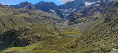
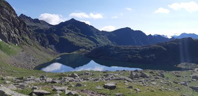
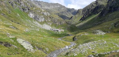
The Texelgruppe / Gruppo di Tessa Nature Park is the largest nature park in South Tyrol. The park is situated between Etschtal / Adige valley in the south, Schnals / Senales valley in the west, Passeier / Passiria valley in the east, and main Alpine crest in the north. The park encompasses the entire Texelgruppe / Gruppo di Tessa mountain range, the Ötztal Alps to the north of it including Schnalser Kamm / Cresta di Senales and Gurgler Kamm mountains, as well as a small part of the Stubai Alps between Timmelsjoch / Giogo del Rombo and Timmelsjochberg / Monte Rombo. The Texelgruppe / Gruppo di Tessa Nature Park, which was established in 1976 and extends over an area of around 31,391 ha, encompasses the villages of Schnals / Senales, Naturns / Naturno, Partschins / Parcines, Algund / Lagundo, Tyrol / Tirolo, Riffian / Rifiano, St. Martin / S. Martino and Moos / Moso in Passeier /Passiria valley. The nature park is part of the Europe-wide Natura 2000 network of protected areas.
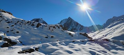
Texelgruppe / Gruppo di Tessa Nature Park– Water and Light The Texelgruppe / Gruppo di Tessa Nature Park is the largest nature park in South Tyrol. The park is situated between Etschtal / Adige valley in the south, Schnals / Senales valley in the west, Passeier / Passiria valley in the east, and main Alpine crest in the north. The park encompasses the entire Texelgruppe / Gruppo di Tessa mountain range, the Ötztal Alps to the north of it including Schnalser Kamm / Cresta di Senales and Gurgler Kamm mountains, as well as a small part of the Stubai Alps between Timmelsjoch / Giogo del Rombo and Timmelsjochberg / Monte Rombo. The entirety of Texelgruppe / Gruppo di Tessa Nature Park is part of the Central Alps from a geological standpoint. In the crystalline rock three areas can be distinguished: the Stubai crystalline in the Timmelsjoch / Giogo del Rombo area (2,509 m), the Ötztal crystalline in the Schnalser Kamm / Cresta di Senales area (also known as the “old gneiss zone”); and the Schneeberg / Monteneve range which encompasses most of the Gurgler range, including Hohe Wilde mountain. Water and ice have significantly contributed to the formation of the park’s valleys and mountains. During the ice age, great glaciers covered the area that is today Texelgruppe / Gruppo di Tessa Nature Park; well mounds were reshaped into cirques, the valleys were carved out, and in the valley floors landscapes rounded in outline or characterized by striations arose. Side glaciers dug less deep thus forming hanging valleys. The most famous attraction, Partschins / Parcines waterfall in Burggrafenamt / Burgraviato, is among the most impressive waterfalls in the Alps in spring when the mountain snow melts. The abundant water of Zielbach rivulet shoots several meters beyond a rock face and then dashes down for 97 meters as a waterfall. On the southern slope of Sonnenberg / Monte Sole mountain in Vinschgau / Venosta valley, secondary steppe-vegetation can be found due to the valley’s arid climate (550 mm of precipitation annually), frequent sunshine, as well as forest clearing and extensive use of the area for grazing for centuries. Nowadays the slopes, which are very sparsely covered with junipers and a colorful mix of berry-bearing shrubs, provide an ideal habitat for various Eastern European steppe inhabitants and Mediterranean, heat-loving flora and fauna. Schnalstal / Val Senales valley has the largest number of sheep in all of South Tyrol. It is a unique, almost primal experience to witness, in late June, the seemingly endless procession of over 1000 sheep being driven through snowfields and glacier firns across Hochjoch / Giogo Alto (2,875 m), Niederjoch / Giogo Basso (3,019 m) and Gurgler Eisjoch / Giogo Gurgl (3,152 m) to the summer pastures of Ötztal. The park is part of the European-wide Natura 2000 sites, which aim to promote habitat, flora and fauna conservation and were established under the EU’s FFH Directive (92/43/EC) and Bird’s Directive (2009/147/EC).
| Emplacement | Italie - Trentino-Alto Adige - Bolzano |
| Site Web | https://naturparks.provinz.bz.it/de/home |
| Zone | 314,07km² |
| Année de fondation | 1976 |
| DtP ID | c12d3b97-0ccf-48e1-8e12-1cd9daebd2e4 |
| Nom et division |
Amt für Natur – Autonome Provinz Bozen-Südtirol
Natur, Landschaft und Raumentwicklung |
| Site Web | http://www.provinz.bz.it/ |
| Adresse |
Afficher l'adresse Masquer l'adresse
Rittnerstraße 4
39100 Bozen Italie |
Utiliser des véhicules motorisés est uniquement autorisé sur les voies publiques.

Camper est interdit.

Faire voler des drones ou des modèles réduits est interdit.
https://civis.bz.it/de/dienste/dienst.html?id=1042564

Allumer un feu est interdit.

Cueillir des plantes est interdit.

Ramasser des champignons est interdit.

Ramasser des minéraux ou des fossiles est interdit.
Autonome Provinz - 6 mai 2010
Autonome Provinz Bozen-Südtirol - 10 avril 1985
ENAC - Direzione Spazio Aereo - 4 avril 2023