

Utiliser des véhicules motorisés est uniquement autorisé sur les voies publiques.
Cette plateforme a été traduite avec l’aide de l’IA. Si vous remarquez des erreurs, les contributions de la communauté sont les bienvenues ; veuillez nous écrire à platform@digitizetheplanet.org.
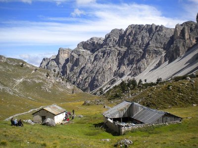
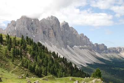
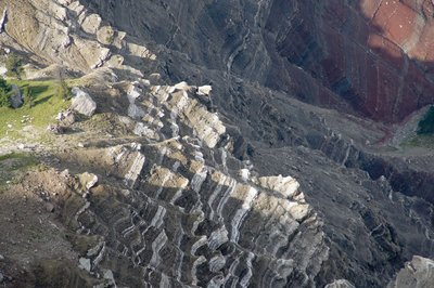
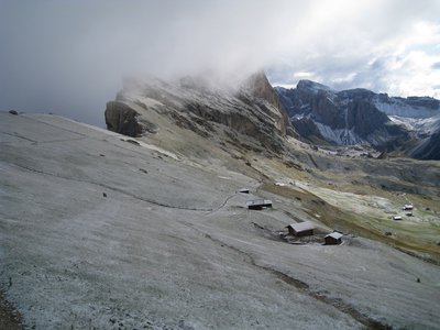
The Puez-Geisler / Puez-Odle Nature Park, which counts as a Dolomites site hut, contains all of the rock types, sediment strata and weathering forms that are characteristic of the Dolomites. The park’s karstic highlands, majestic rock faces, rolling Alpine pastures set off against bizarre looking backdrops of cleft mountains, valleys formed by extreme erosion, and dark coniferous forests comprise a multifarious landscape that is rarely found in such a small area. The Nature Park, which was established in 1978 and extends over an area of around 10,722 ha, encompasses the villages of Abtei / Badia, Corvara, Villnöss / Funes, St.Martin in Thurn / S. Martino in Badia, St.Ulrich / Ortisei, St. Christina / S. Cristina in Gröden and Wolkenstein in Gröden / Selva di Gardena. The Nature Park is part of the European-wide Natura 2000 sites and is also part of the Dolomites UNESCO World Heritage Site.
Puez-Geisler / Puez-Odle Nature Park - History book of the Earth. The Puez-Geisler / Puez-Odle Nature Park, which counts as a Dolomites site hut, contains all of the rock types, sediment strata and weathering forms that are characteristic of the Dolomites. The park’s karstic highlands, majestic rock faces, rolling Alpine pastures set off against bizarre looking backdrops of cleft mountains, valleys formed by extreme erosion, and dark coniferous forests comprise a multifarious landscape that is rarely found in such a small area. The Puez-Geisler / Puez-Odle Nature Park extends to Würzjoch / Passo delle Erbe in the north, Grödner Joch / Passo Gardena in the south, Gadertal / Val Badia valley (Kampill, Untermoj / Longiarü, Antermöia) in the east and Villnößtal / Val di Funes and Grödntal / Val Gardena in the west. The northern portion of the park encompasses Aferer / Odle di Eores, Villnösser Geisler / Odle di Funes and Peitlerkofel / Sas da Pütia, while the southern portion encompasses the highlands of Gherdenacia, Sassongher, Puez (including Langental / Vallunga) and the Cir mountains. Founded in 1978, the park extends over an area of around 10,722 hectares belonging to the villages of Abtei / Badia, Corvara, Villnöss / Funes, St.Martin in Thurn / S. Martino in Badia, St.Ulrich / Ortisei, St. Christina / S. Cristina in Gröden and Wolkenstein in Gröden / Selva di Gardena. Apart from Villnösstal / Val di Funes, all of the park’s other municipalities are Ladin communities: St. Christina/Santa Crestina, Wolkenstein/Sëlva, Abtei/Badia and Corvara in the south, and St. Martin in Thurn/San Martin de Tor in the east. The park is part of the European-wide Natura 2000 sites, which aim to promote habitat, flora and fauna conservation and were established under the EU’s FFH Directive (92/43/EC) and Bird’s Directive (2009/147/EC). The nature park is also part of the Dolomites UNESCO World Heritage Site.
| Emplacement | Italie - Trentino-Alto Adige - Bolzano |
| Site Web | https://naturparks.provinz.bz.it/de/home |
| Zone | 107,29km² |
| Année de fondation | 1978 |
| DtP ID | 6129cac9-bbae-4a13-a189-5f89e37c03c2 |
| Nom et division |
Amt für Natur – Autonome Provinz Bozen-Südtirol
Natur, Landschaft und Raumentwicklung |
| Site Web | http://www.provinz.bz.it/ |
| Adresse |
Afficher l'adresse Masquer l'adresse
Rittnerstraße 4
39100 Bozen Italie |
Utiliser des véhicules motorisés est uniquement autorisé sur les voies publiques.

Camper est interdit.

Faire voler des drones ou des modèles réduits est interdit.
https://civis.bz.it/de/dienste/dienst.html?id=1042564

Allumer un feu est interdit.

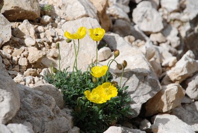
Cueillir des plantes est interdit.

Ramasser des champignons est interdit.

Ramasser des minéraux ou des fossiles est interdit.
Autonome Provinz - 6 mai 2010
Autonome Provinz Bozen-Südtirol - 31 octobre 1977
ENAC - Direzione Spazio Aereo - 4 avril 2023